


|
|
|
|
|||||||||||||||||||||||||||||||||||||
|
|
|||||||||||||||||||||||||||||||||||||||
|
| |
|
|||||||||||||||||||||||||||||||||||||
| |
|
||||||||||||||||||||||||||||||||||||||
|
| |
|
|||||||||||||||||||||||||||||||||||||
|
|
|||||||||||||||||||||||||||||||||||||||
| |
|
|
|||||||||||||||||||||||||||||||||||||
|
||||||||||||||||||||||||||||||||||||||||
|
|
|||||||||||||||||||||||||||||||||||||||
|
||||||||||||||||||||||||||||||||||||||||
|
|
|
|
|||||||||||||||||||||||||||||||||||||
|
||||||||||||||||||||||||||||||||||||||||
|
|
|
|
|
|
|||||||||||||||||||||||||||||||||||
|
|
|
||||||||||||||||||||||||||||||||||||||
|
|
|
|
|
||||||||||||||||||||||||||||||||||||
|
|
|
|
|||||||||||||||||||||||||||||||||||||
| | |
||||||||||||||||||||||||||||||||||||||
|
|
|
||||||||||||||||||||||||||||||||||||||
|
||||||||||||||||||||||||||||||||||||||||
|
|
|
||||||||||||||||||||||||||||||||||||||
|
||||||||||||||||||||||||||||||||||||||||
|
|
|||||||||||||||||||||||||||||||||||||||
|
|
|||||||||||||||||||||||||||||||||||||||
|
||||||||||||||||||||||||||||||||||||||||
|
||||||||||||||||||||||||||||||||||||||||

to the new menu
THIS SELECTION IS FOR STUDENT BROWSING
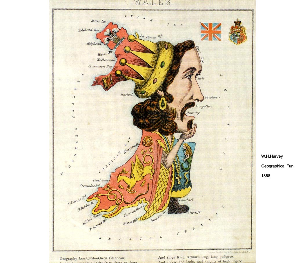
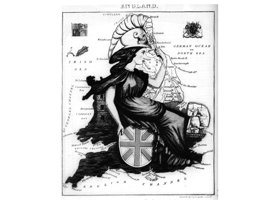
MERCATOR THE BRITISH ISLES ATLAS TITLE PAGES MAPS IN BOOKS ANTHROPOMORPHIC from a book of Geographical Fun, Humourous Outlines of Various Countries, Hodder & Stoughton 1869; lithographs published by Vincent Brooks, Day & Son after drawings by a young girl with copy by ALEPH (?)
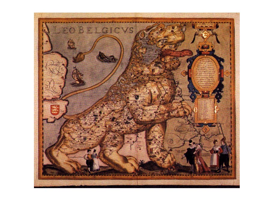
Pieter van
den Keevere's Leo Belgicus, the seventeen provinces of the United Netherlands
MAPMAKING
Read these three examples of the mapping of deltas (vertically)
- analyse how accretions of knowledge gradually change the way a coastline
is mapped. From A.E.Nordenskiold, Periplus: An Essay on the Early History
of Charts and Sailing Directions, 1897, and printed in The Map Collector
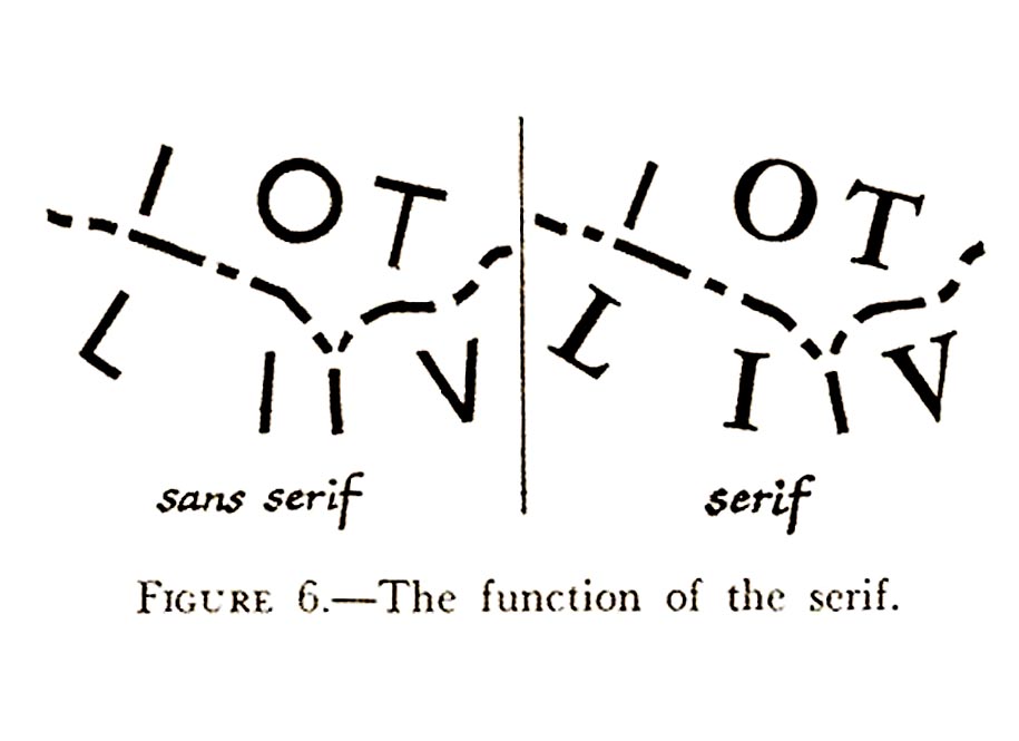
December 1982. SERIF/SANS
SERIF The great American cartographer Richard Edes Harrison encourages
the use of serif letters in maps to avoid confusion. CONTOUR
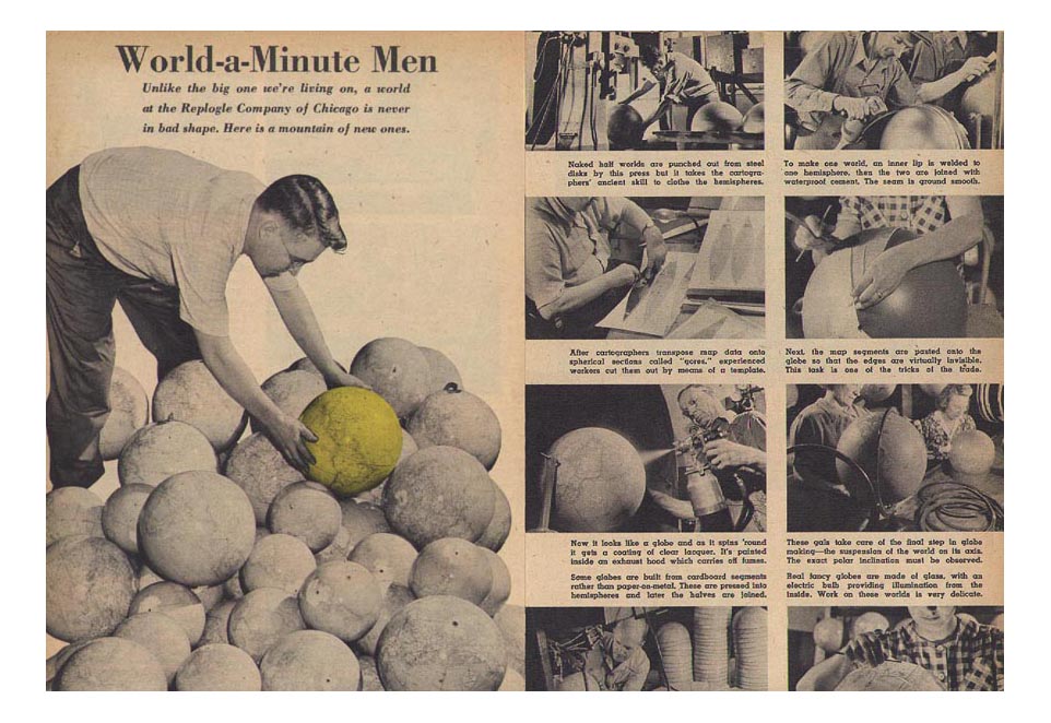
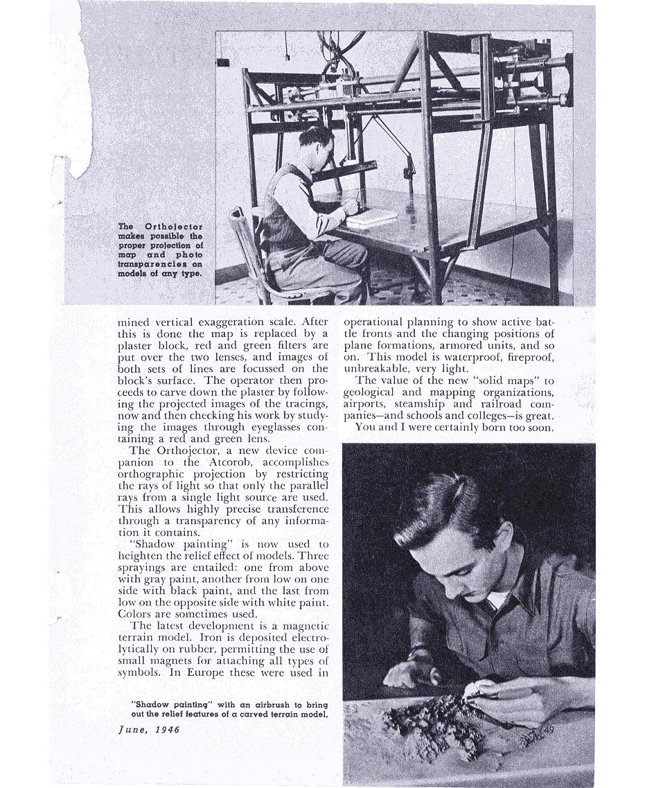
MAPPING from Mechanix Illustrated June 1946 MAKING
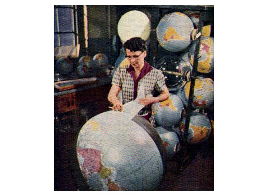
THE GLOBES A worker applies the adhesive shaped panels to the
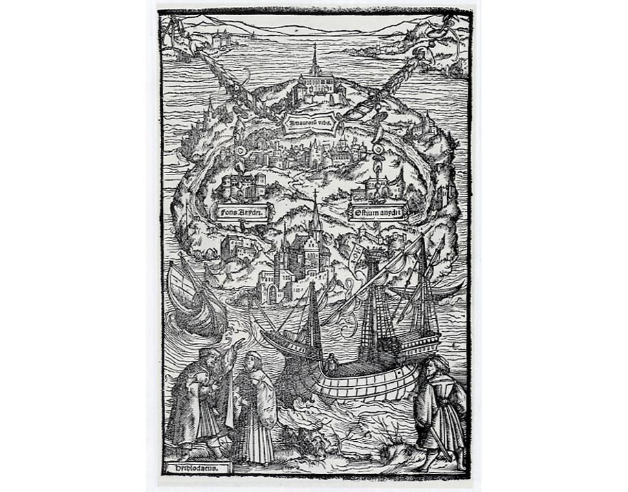
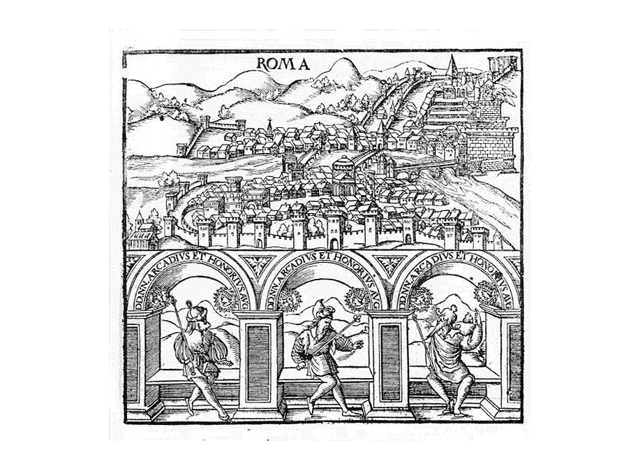
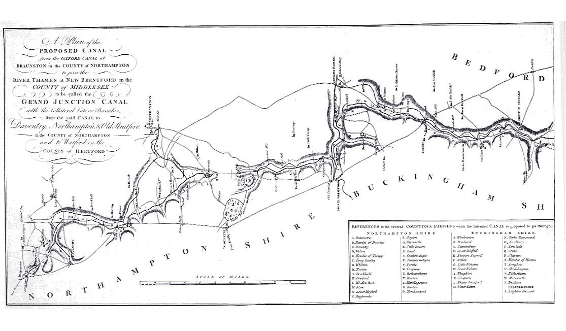
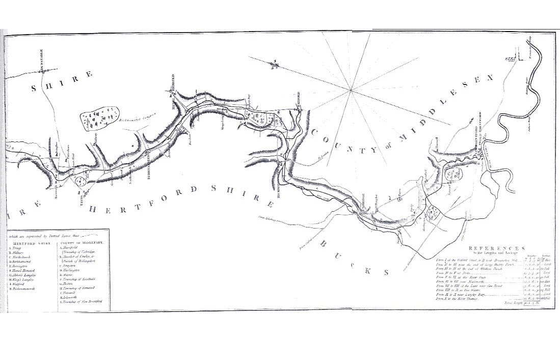
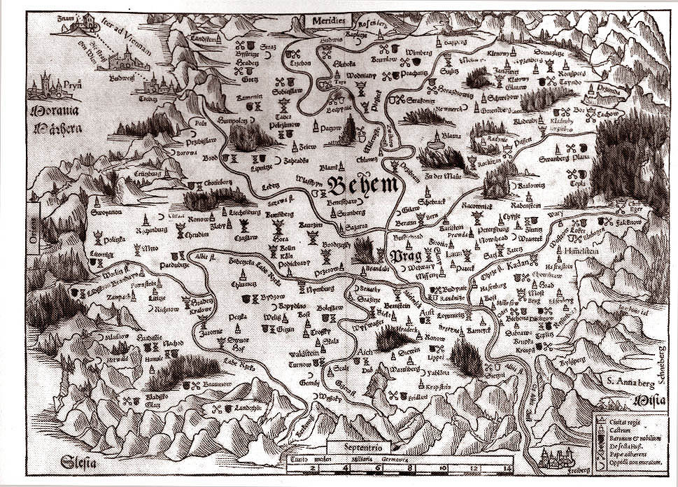
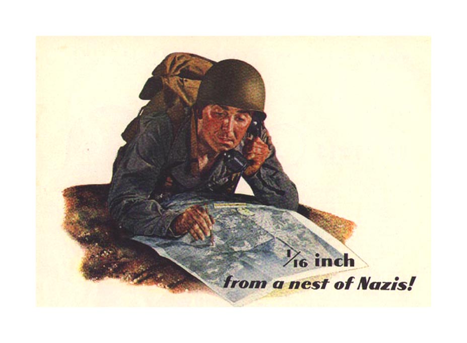
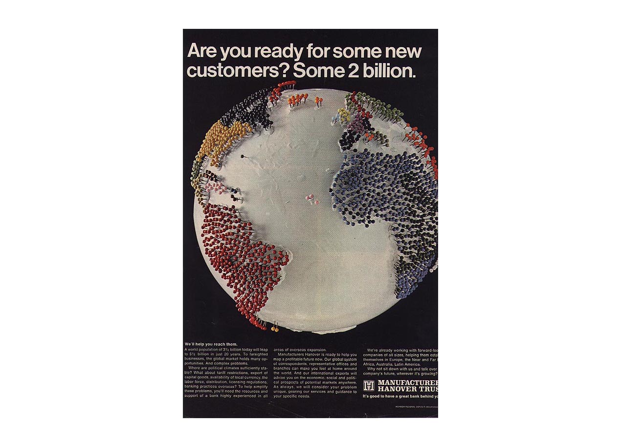
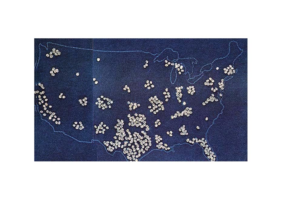
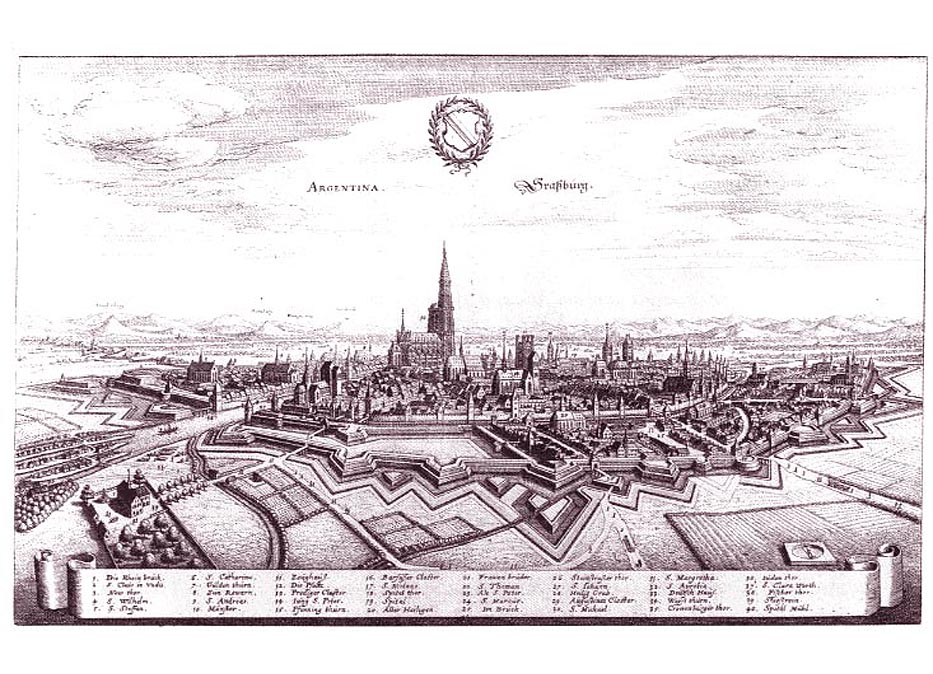
base globe. FORMATS OF MAPS Early view of Rome from Gelenius' Description of the Roman Empire under Honorius and Arcadius .Here the oblique angle with representational intent. Together with a three bay arcade with figures and landscape beyond. Published in Basle in 1552. From an edition of Ptolemy (from 1545) - an early example of a themes map, where the information makes clear visual differentiation between two religious affiliations - Catholic and Hussite. THE GRAND JUNCTION CANAL - two halves c1820 MAPS IN ADVERTISEMENTS GRAPHIC CONVENTIONS POINTS
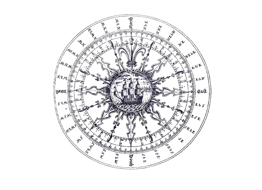
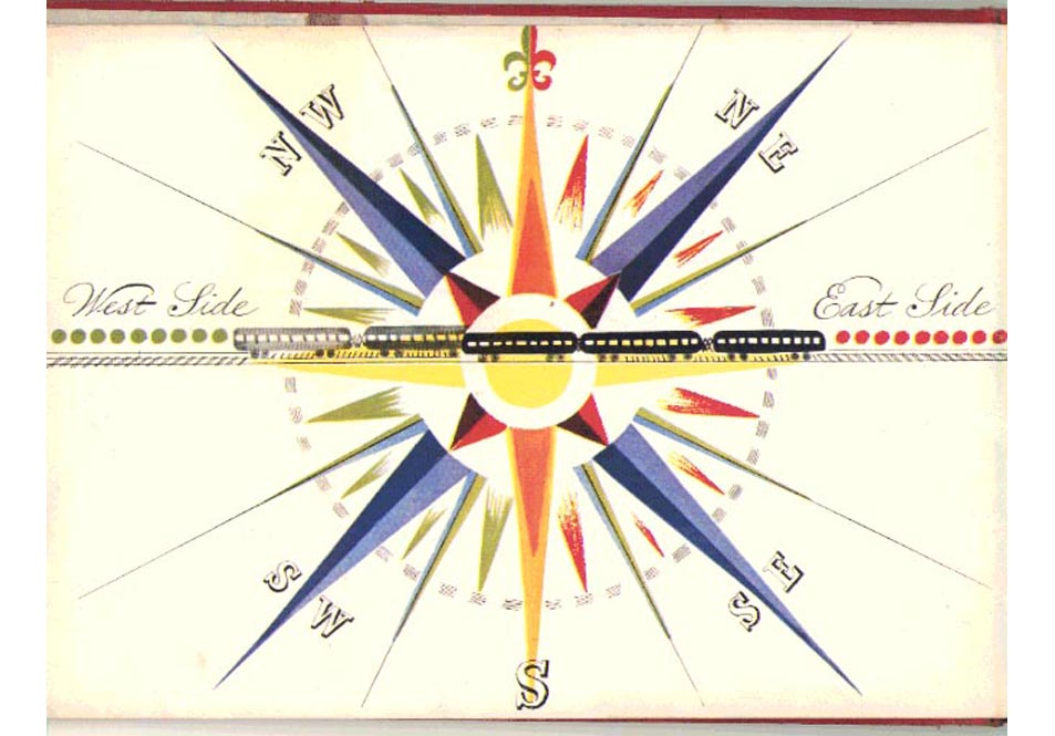
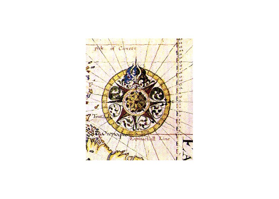
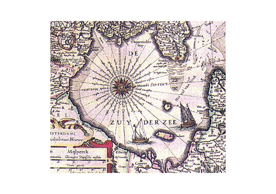
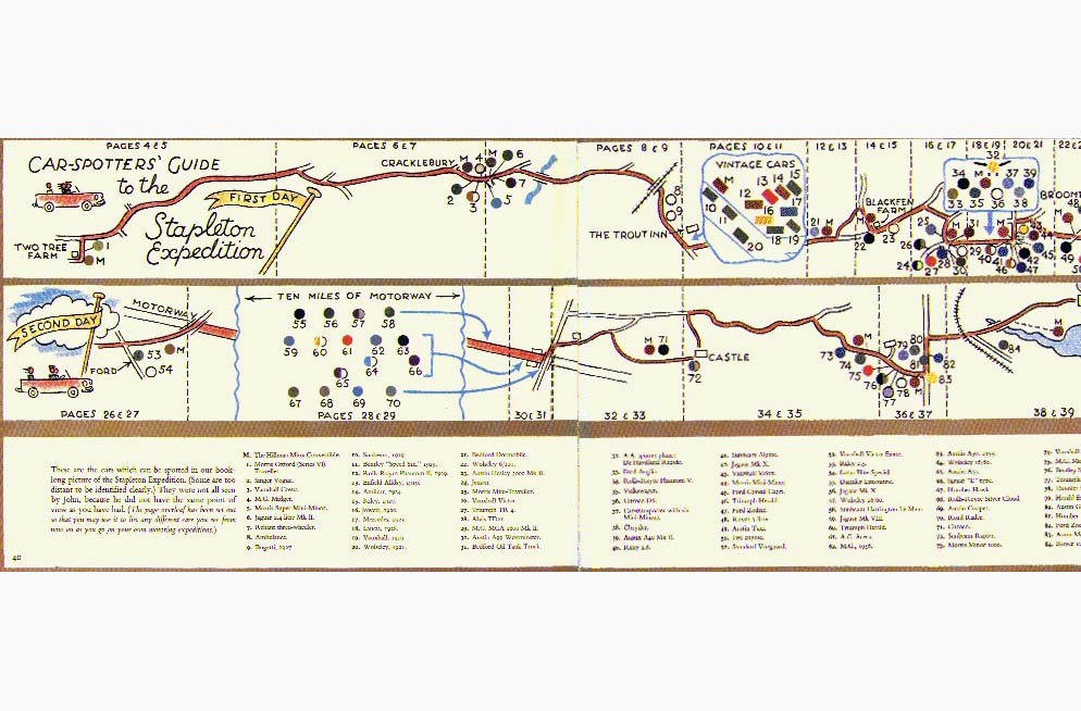
OF THE COMPASS The Runaway
Shuttle Train, Story by Muriel Fuller and Pictures by Dorathea Dana, David
McKay Company, Washington Square, Philadelphia, 1946. The story began
as The Lost Shuttle Train in 1941. Each page measures 17 x 24cms. published
at the end of the 15th century, original title unknown.
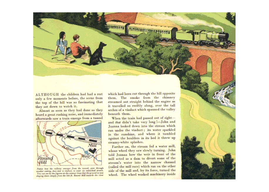
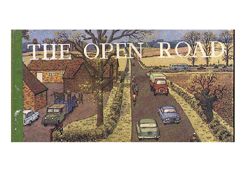
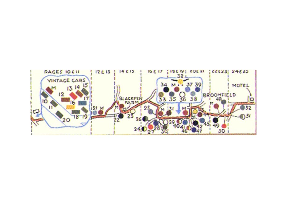
RONALD
LAMPITT
WARMAPS
SUBJECTIVE MAP The Surrealist apportioning the world's land mass.
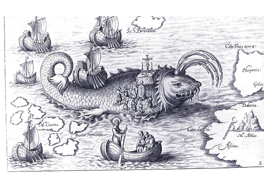
GRAPHIC
CONVENTIONS The map and the elevation on the same sheet. Plautus
(the Abbot of Seitenstetten, Novus Typis transacta Navigatio Novi Orbis
Iniae Occidentalis ... Linz 1621. The engraving, by Wolfgang Kilian, shows
St.Brandan celebrating Mass on a Whale's back. The scale is made even
more absurd by the intervention of the conventions of traditional cartography.
MAPS IN
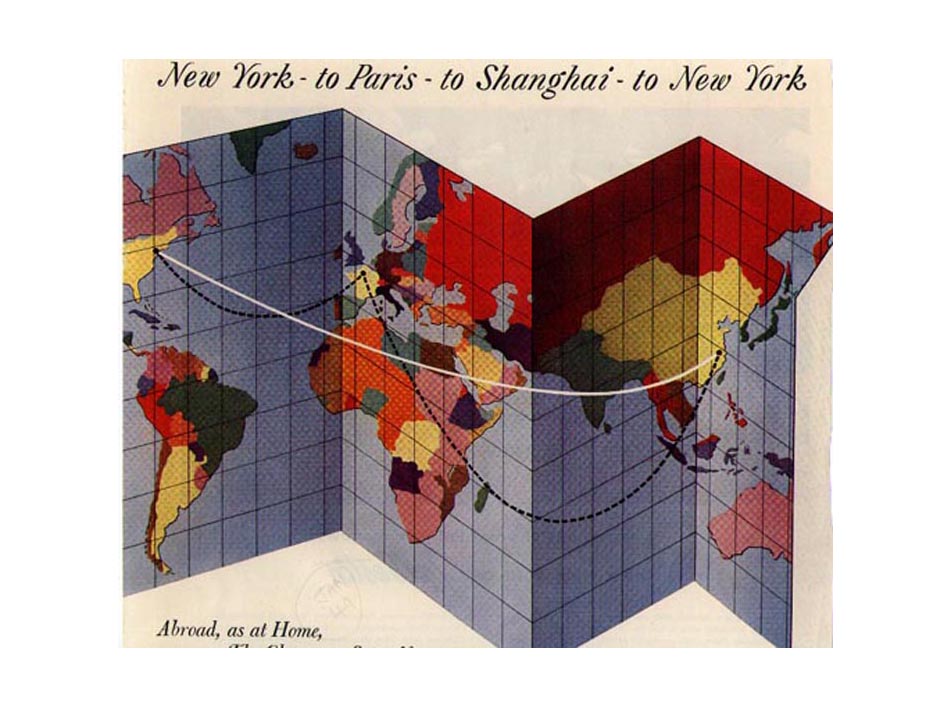
ADS
|