GULLIVER Rex
Whistler's illustrated maps for Gulliver's Travels , Cresset Press
London 1934. And illustrations and decorations to Swift's Gulliver's
Travels, Peter Pauper Press, Mount Vernon, New York, undated,10 x 18cms
.
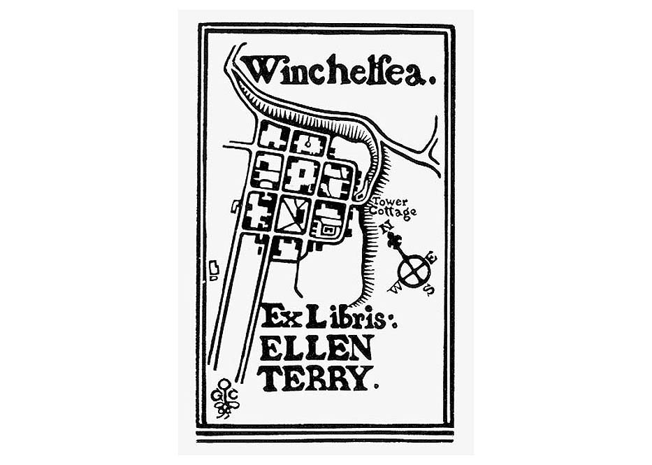
TOP RIGHT
Edward Gordon Craig's ex libris plate for his mother Ellen Terry
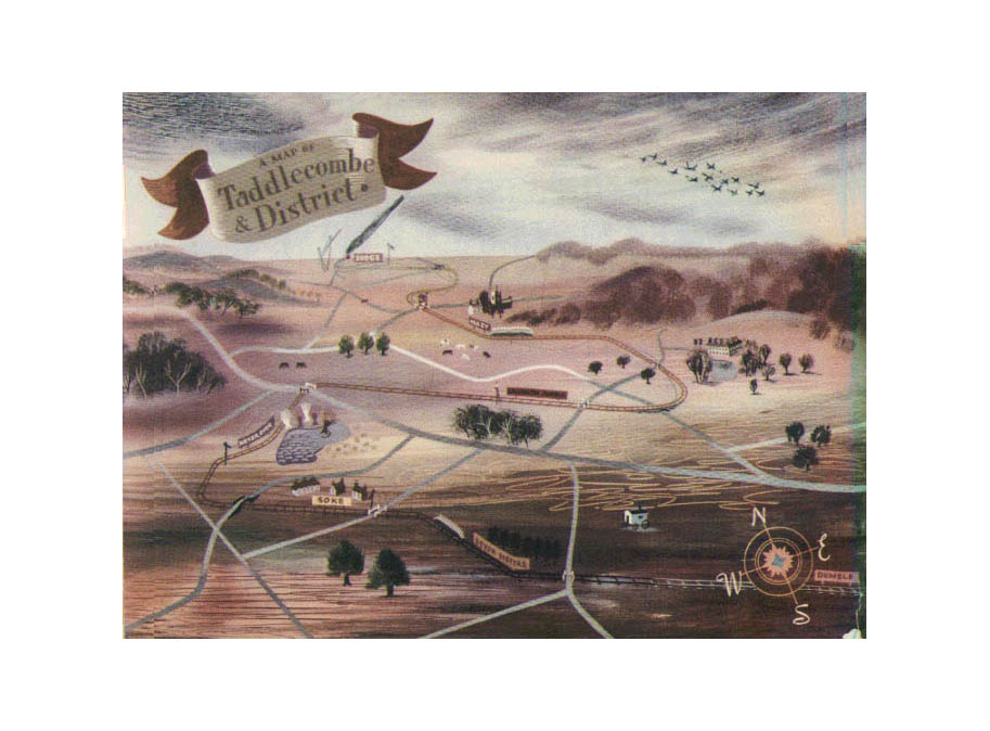
TOP RIGHT
Leslie Wood's illustration Taddlecombe and District
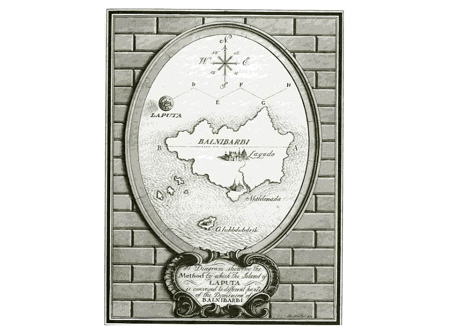
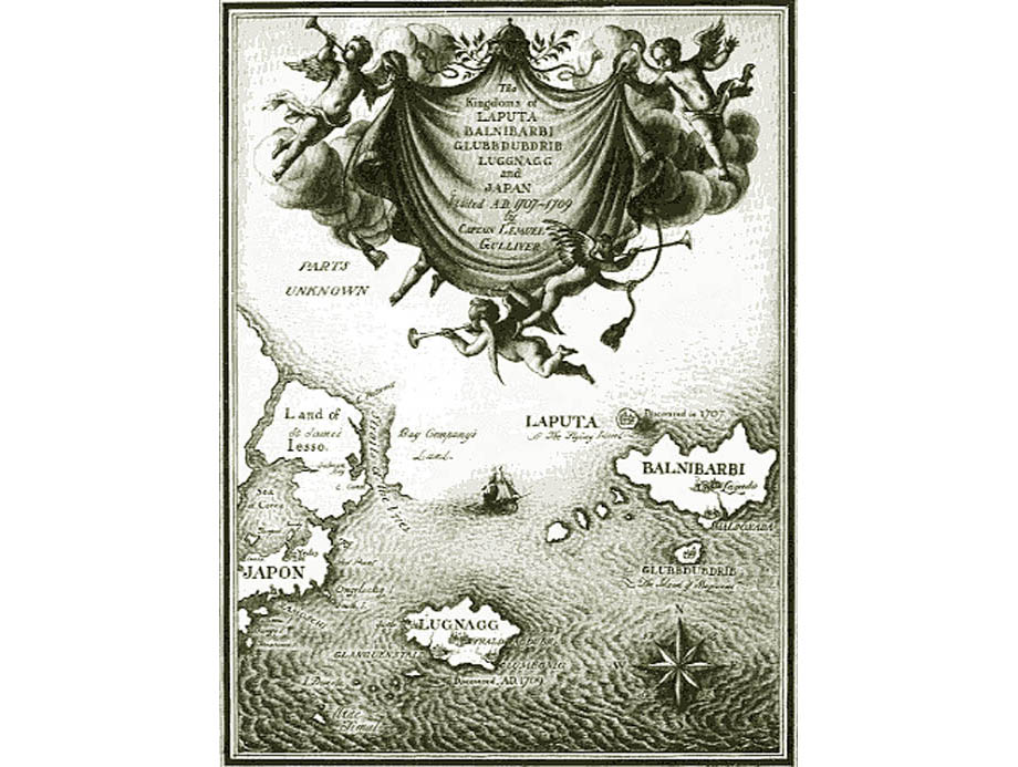
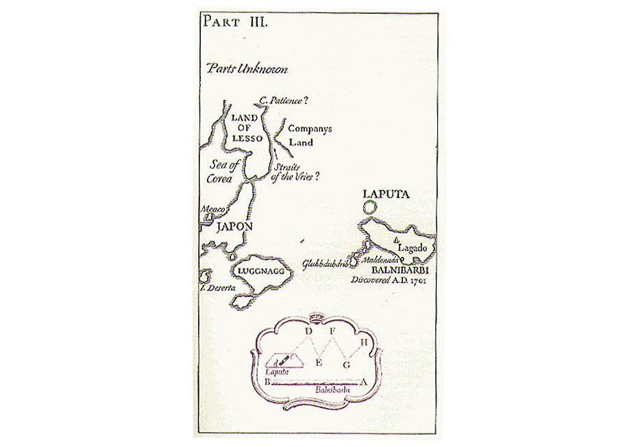
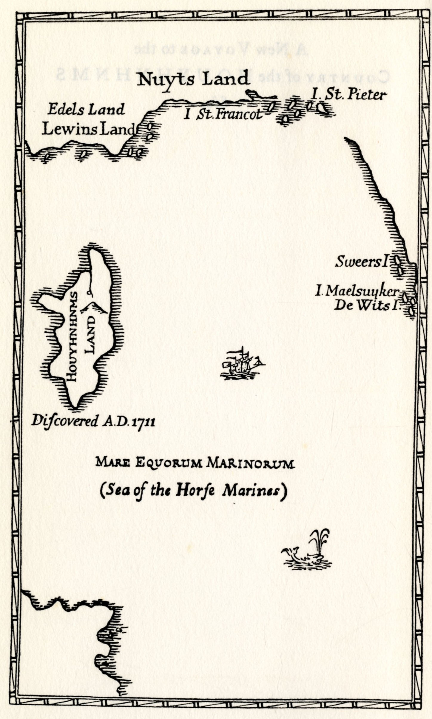
 Map of the Voyage to the Country of the Houyhnhnms,Gulliver's Travels (Part Five) Map of the Voyage to the Country of the Houyhnhnms,Gulliver's Travels (Part Five)
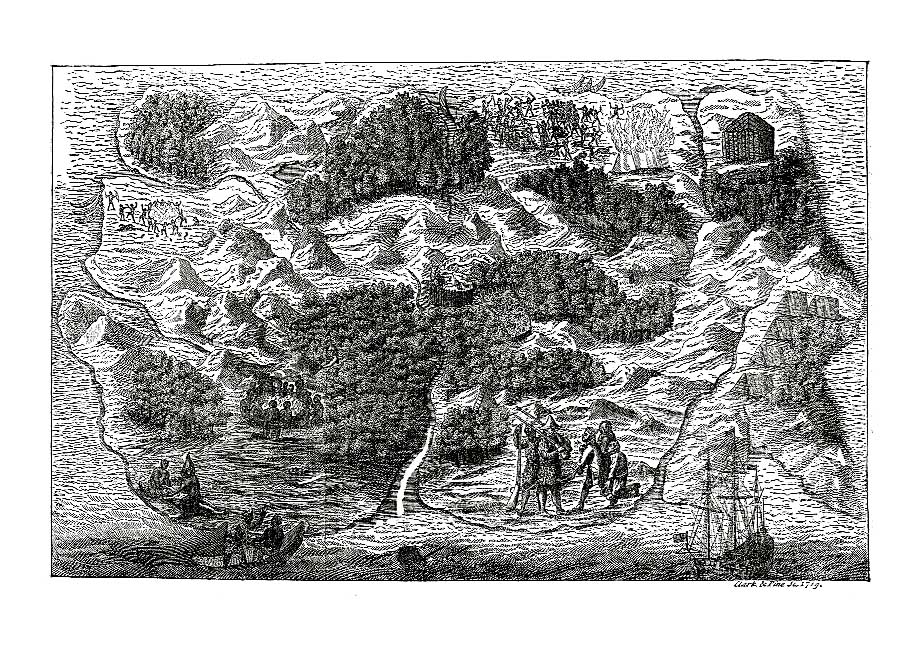
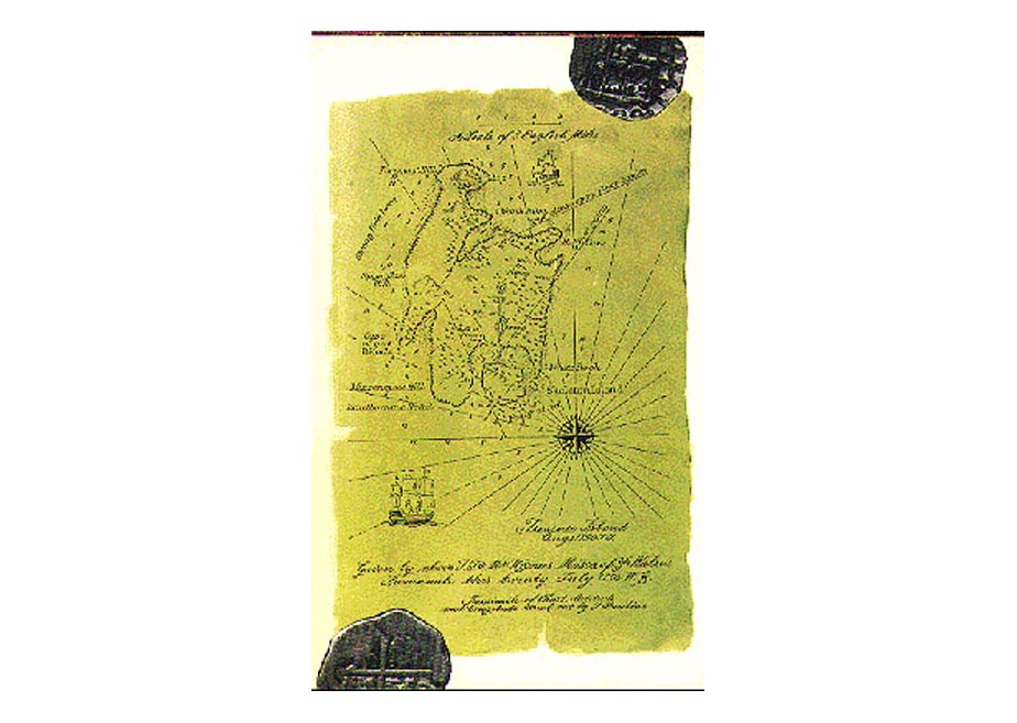
ROBINSON CRUSOE A Map of Robinson Crusoe's Island, from the
first edition of Volume III. Dated 1719; See BIBLIOGRAPHICA, Part VI, "Robinson
Crusoe and Its Illustrators".
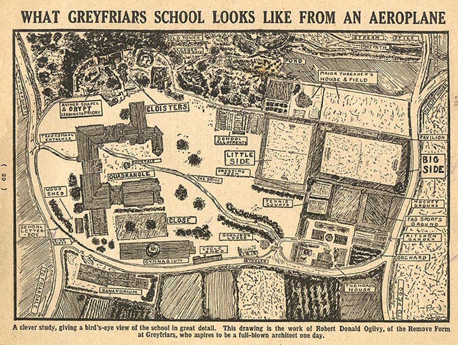
GREYFRIARS from
THE 1922 HOLIDAY ANNUAL
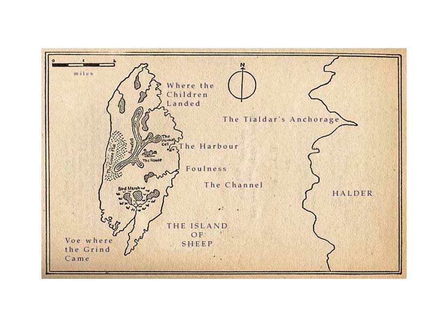
BUCHAN from John Buchan's novel The Island of Sheep
first published in 1936
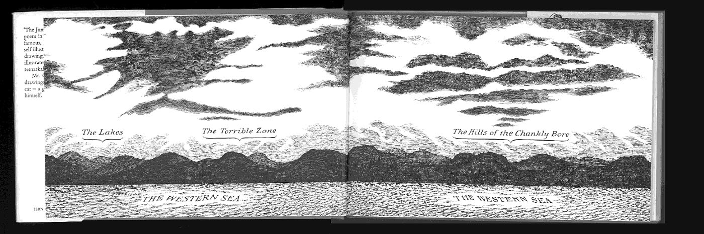
GOREY LEAR THE JUMBLIES measuring 14 x 10cms Edward
Gorey's inspired double page spread setting the scene for his illustrated
version of Edward Lear's The Jumblies, published
in 1968 by Chatto
& Windus, measuring 14 x 42 cms. It preceds the titlepage but is
not an end paper. It is repeated at the end. "For they'd been to
the lakes, and the Torrible Zone,
And the Hills of the Chankly Bore...."
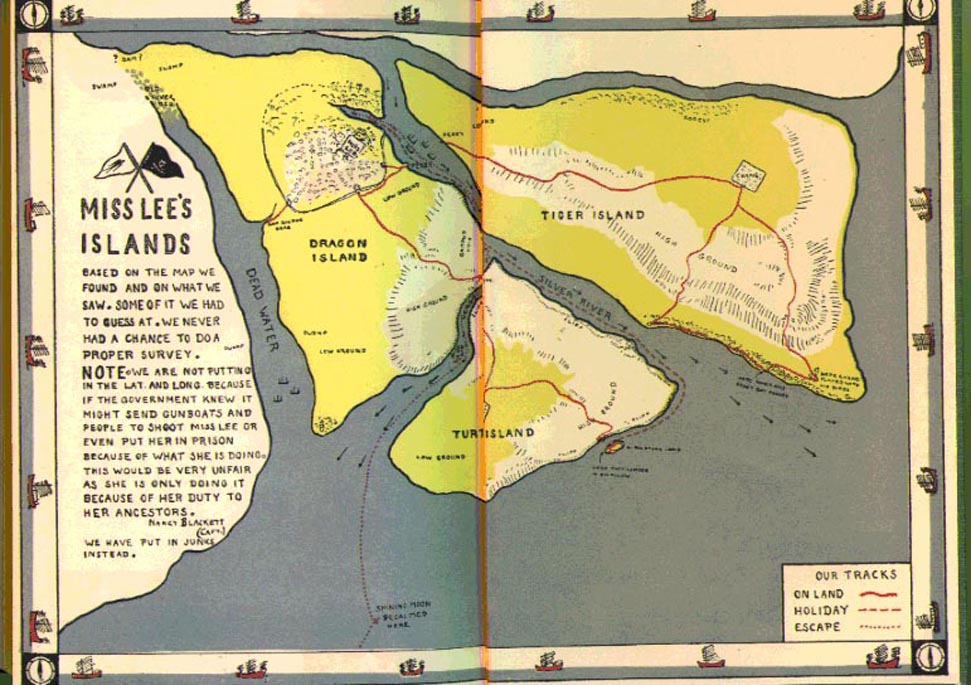
RANSOME Arthur
Ransome Missee Lee, Cape, London, 1941 20 x27cms; a children's
fictitious adventure set off the coast of China; here with clear colour coded
tracks that correspond exactly with the narrative.
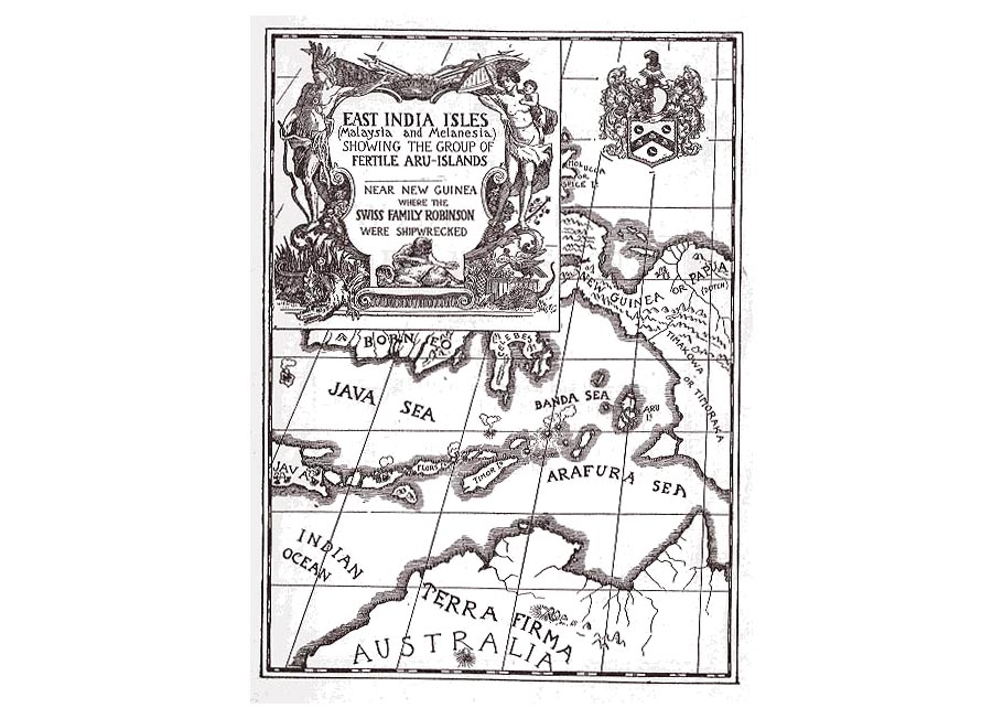
SWISS FAMILY ROBINSON Louis Rhead , Illustrations to David
Wyss' The Swiss Family Robinson, Harper's New York 1909.
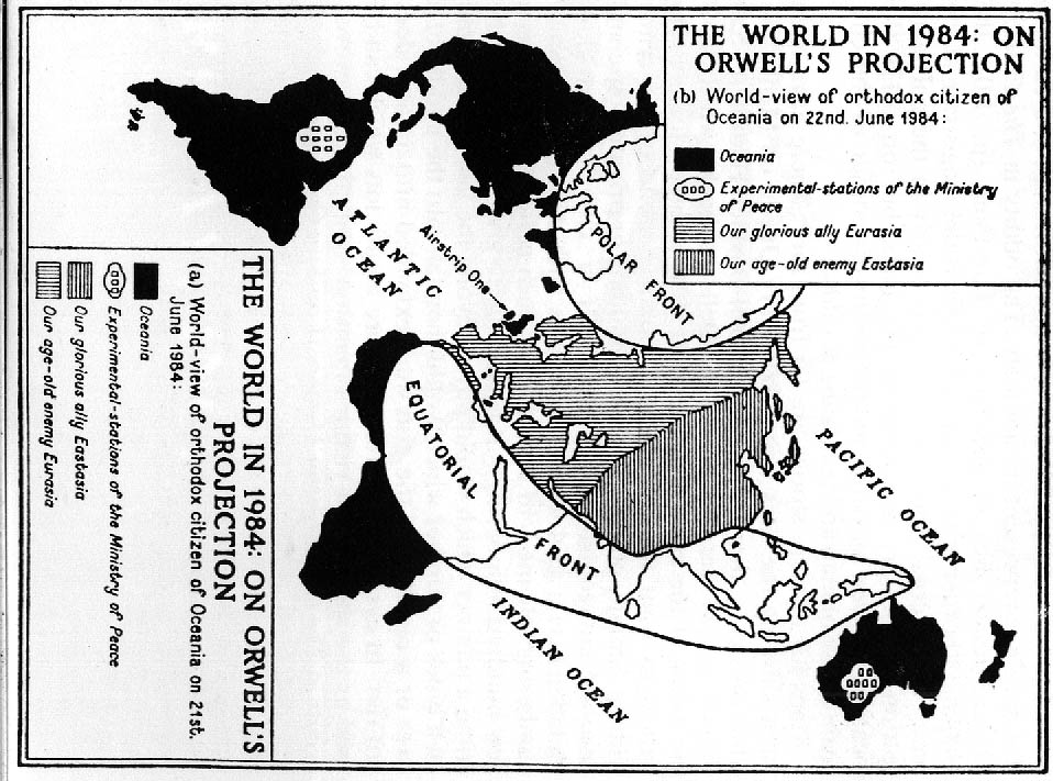
1984 A
map that can be viewed from two directions, George Orwell's concept
of the world drawn by Josef-Jan Szostak, from R.C.Churchill, A Short
History of the Future, published by The Bodley Head 1955.
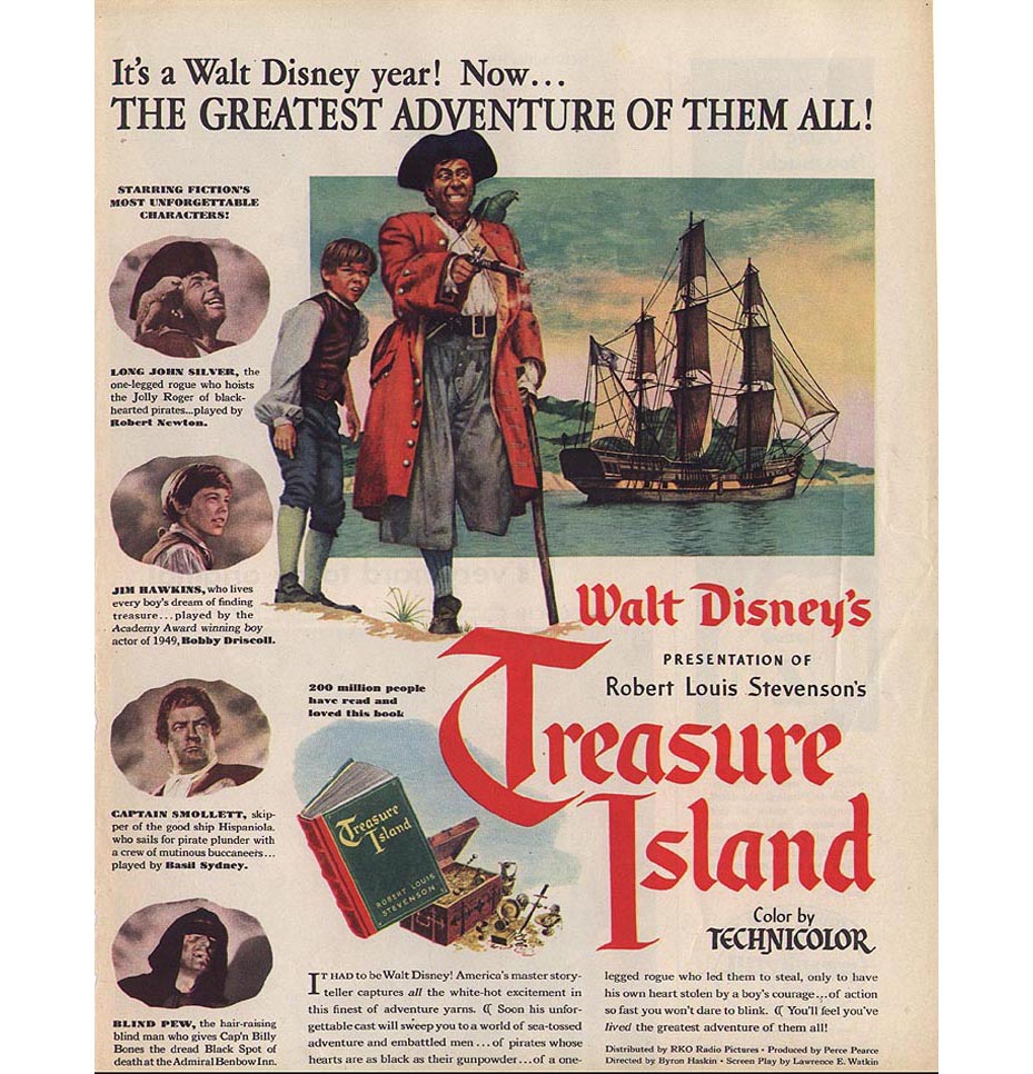
TREASURE
ISLAND
The advert
for the movie.
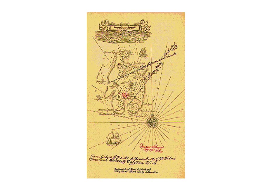
01 map included in the Cassell edition London c1905, 20.5 x 14 cms.
02 from George Hardie's illustrations to Treasure Island , Armada London
1989, paperback, detail 10 x 7 cms
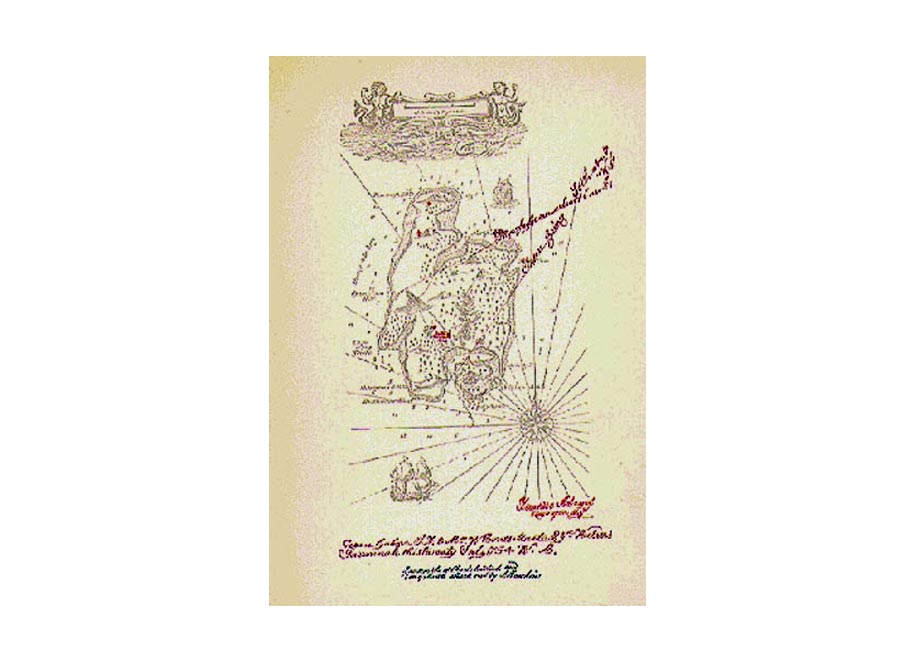
03 Map included in the Eyre and Spottiswoode edition, illustrated by
Mervyn Peake, 1949, virtually copied from the above but with significant
changes, 22 x 14.5 cms.
04 Map as frontispiece in the Josef Hochman illustrated edition produced
in Czechoslovakia, and published in Britain by Hamlyn in 1967. 24 x 16
cms.
see also 4 illustrators |