MAPS
AS POLITICAL STATEMENTS ...... MAPS
RECORDING ACTUALITIES
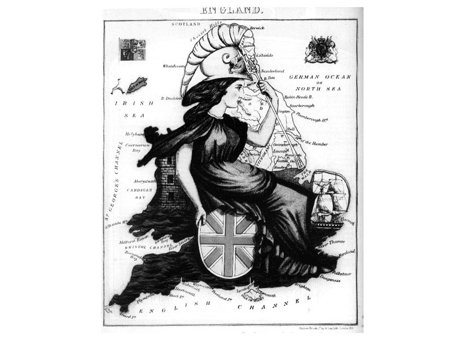
TOP ROW 01 Landmass becomes Britannia.Unknown
TOP ROW
02 JAMES FRANCIS HORRABIN (1884 - 1962) This is a sumptuous map signed
JFH and otherwise unacknowledged from The Communist ,
the weekly organ of the Young Communist party; see E.Hobsbawm, intro,
Communist Cartoons , Klugman Pictorials Ltd., London
1982.
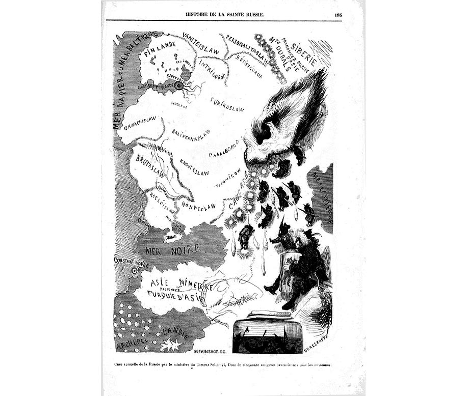
TOP 03
Illustration by Gustave Dore Histoire de la Sainte Russe Paris
1854
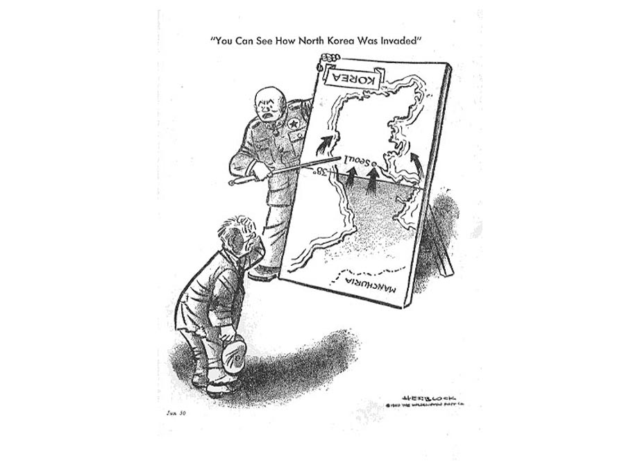
MIDDLE 01 From the admirable The Herblock Book, Beacon
Books, Boston, 1952 Herblock's cartoon June 1950 for the Washington Post
neatly making the point of who invaded who by reversing the map.
MIDDLE
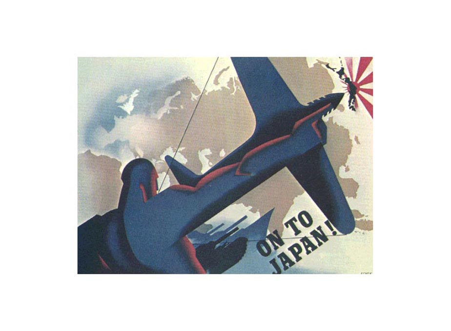
02 SEVEK ; On to Japan, poster c1843 measuring 65 x 48 cms
MIDDLE 03
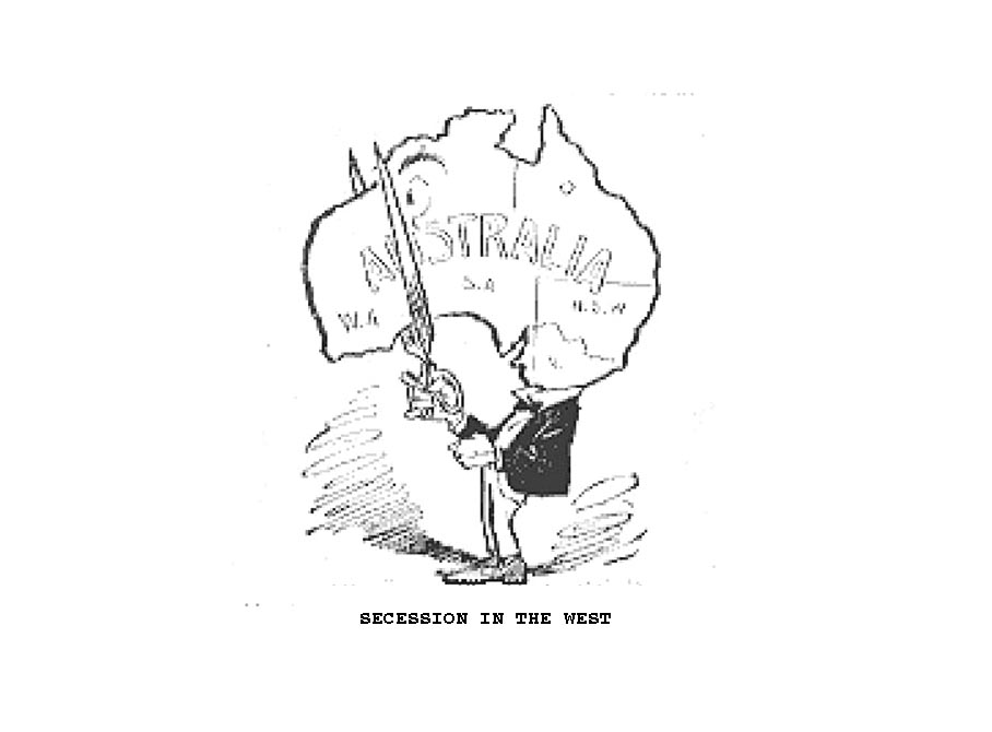
Cartoon attacking secessionists in Western Australia, from Melbourne Punc
hand reproduced The Passing Show February 1921
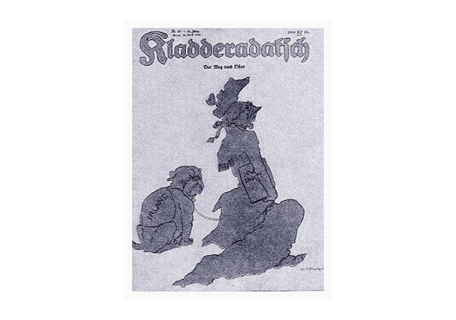
BOTTOM " The Road to the East ; Quo Vadis, Britannia ?" from
Kladderdatsch, 1939, from W.G.Knop, Beware the English
, Hamilton London 1939, a well drawn depiction of the censorious Governess,
and truculent mutt (Ireland/Eire)
 Robert Dighton, three comical maps Robert Dighton, three comical maps
Jerusalem
Armistice Lines 1948
Sidney
Strube, The Financial Main 1933
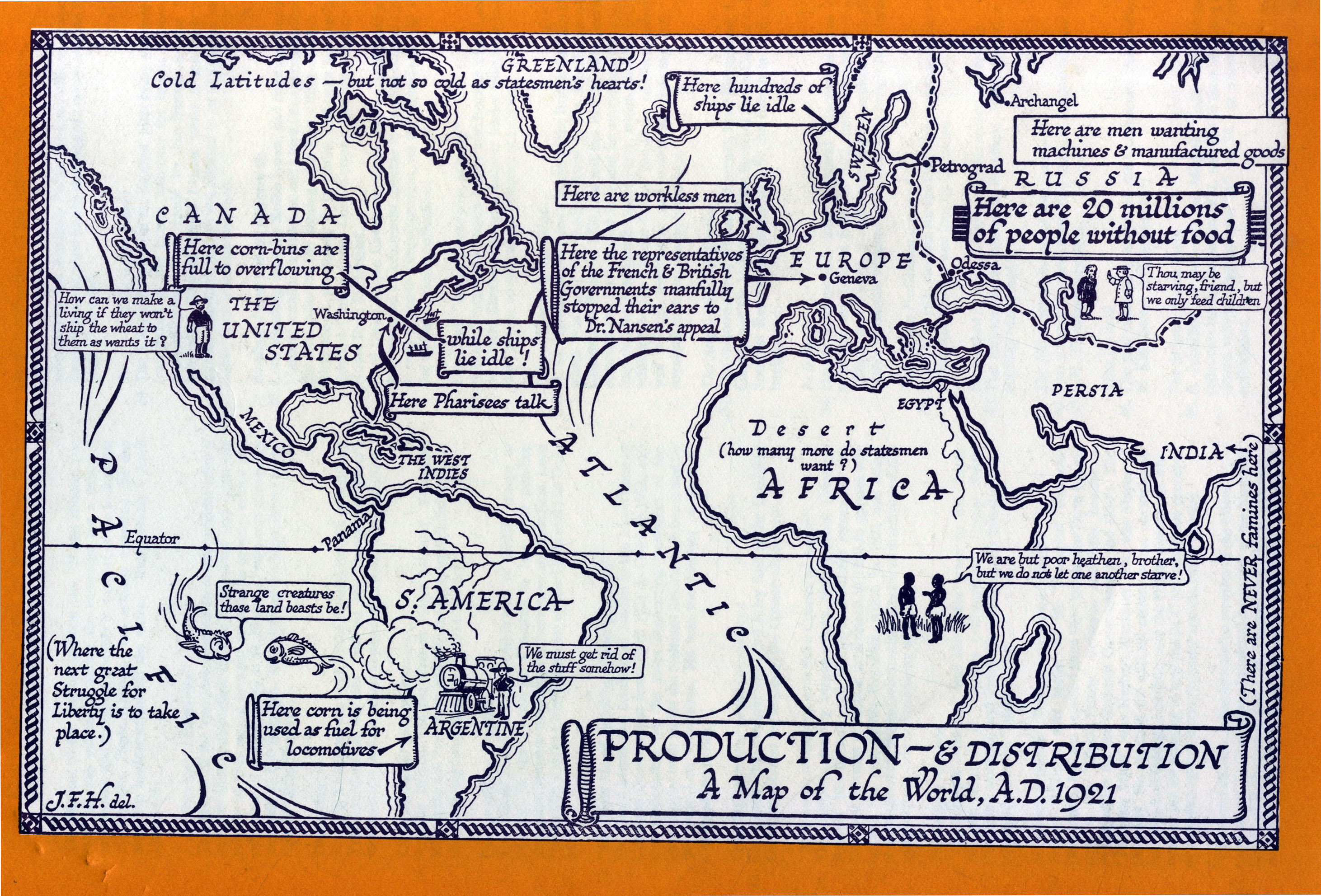
J.F.Horrabin, Production and Distribution 1921
anon, COMIC
MAP OF EUROPE
anon,
Newsmap of a Troubled Continent May 1939
French
Designs on Italy, from The Picture Magazine 1894
Britannia
Personified, undated (GM) , from The Picture Magazine 1894
|